Michael Sheldon's Stuff

Michael Sheldon (mike at mikeasoft dot com)

January 5, 2011

Free (as in GPL2) translation dictionaries for the Kindle
Mike @ 3:52 pm

Update: All dictionaries except for Welsh and Esperanto (which aren’t supported by kindlegen) have been updated to work with the Kindle 4.

I’ve had a Kindle for a little while and really like it, but one of the areas it seems to be somewhat lacking in is the availability of translation dictionaries, as such I knocked up a quick script to convert TinyLex dictionaries from the Apertium project into indexed Kindle dictionaries. The most useful of these is probably the German – English dictionaries as these are very complete (over 160,000 entries).

One thing that I find quite useful is setting the German -> English dictionary as my primary dictionary (instructions below) then opening the English -> German dictionary and searching for words (or vice versa), this way you can get an instant re-translation of any words suggested to you.

Installation

Kindle 3

  1. Download whichever dictionary you’re interested in from the list below.
  2. Transfer the file across to your Kindle as normal.
  3. Press the menu key on your Kindle.
  4. Select Settings.
  5. Press the menu key again.
  6. Select Change Primary Dictionary.
  7. Select your new dictionary from the list.

Kindle 4

  1. Download whichever dictionary you’re interested in from the list below.
  2. Transfer the file across to your Kindle as normal.

If this is the only dictionary you have for this language you’re now done. If you have multiple dictionaries continue:

  1. Press the menu key on your Kindle.
  2. Select Settings.
  3. Select edit next to Dictionaries on the second page.
  4. Select the language you wish to set the dictionary for.
  5. Select your new dictionary from the list.


Afrikaans

English -> Afrikaans 5165 entries
Afrikaans -> English 5195 entries

Esperanto

English -> Esperanto 12344 entries
Esperanto -> English 21316 entries

French

English -> French 6315 entries
French -> English 6304 entries

German (includes phrases)

English -> German 162004 entries
German -> English 166733 entries

Polish

English -> Polish 8107 entries
Polish -> English 9373 entries

Portuguese

English -> Portuguese 4759 entries
Portuguese -> English 4609 entries

Spanish

English -> Spanish 8488 entries
Spanish -> English 8769 entries

Welsh

English -> Welsh 6674 entries
Welsh -> English 8632 entries

Scripts

For those of you interested in the scripts used to generate these dictionaries, they can now be downloaded here: kindle-dict.tar.gz.

Most of the heavy lifting is done by the tab2opf.py script from StarDict-Lingea, the tinylex.sh script will do the necessary conversion to get a tinylex dictionary into a tab delimited format suitable for use by tab2opf.py, it’ll then run tab2opf.py and kindlegen on the output, providing you with a Mobipocket dictionary for use with the Kindle. See the README for more in depth instructions on how to make use of it.


October 16, 2010

Libre Droid 1.4 Released
Mike @ 8:58 pm

I’ve just released a new version of Libre Droid onto the Android Market (also downloadable here: http://mikeasoft.com/~mike/libredroid-1.4.apk). The main changes in this release are:

  • Android 2.2 (Froyo) support – Previous versions didn’t work under Froyo due to the new streaming framework (libstagefright) not supporting HTTP redirection, so resolving the final URL is now handled by Libre Droid itself.
  • Ability to add custom tag stations – You’re no longer restricted to the preset tag stations so if you want to listen to female vocals, finger picked guitar, monkeys or anything else our music might be tagged with then you can create a dedicated station for it.
  • Support for playing a user’s loved station – All the music you’ve ever loved in one easy station.
  • Support for the community loved station – The Libre.fm community’s favourite music, this is a selection of all the music that’s ever been loved by any of our users with the most popular tracks playing most frequently.
  • New artwork.
  • Plus a few miscellaneous bug fixes.

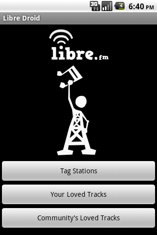
New menu page in Libre Droid

Libre Droid playing some music

To access it directly on your phone either scan the QR code below or click on it from within your phone’s browser. Alternatively you can simply search for “Libre Droid” in the Android Market.

QR code for Libre Droid


September 24, 2010

Local map rendering and route finding with libchamplain, Spatialite and Open Street Map
Mike @ 3:07 pm

This tutorial takes you through the steps necessary to build a simple application which is capable of displaying data from OpenStreetMap and find driving routes between two locations without the need for any network services.

The final application will look something like this:

Final application demonstrating local render and routing

And can even be used on the Nokia N900 mobile phone (running Maemo):

Local map rendering and routing on the Nokia n900 mobile phone

Preparation

The libraries you’ll need to install for this are:

  • Memphis – A map renderer. Version 0.2.1 or later.
  • libchamplain – Provides clutter based mapping widgets. You’ll need version 0.7.1 or later for memphis support, when compiling add –enable-memphis to the ./configure parameters.
  • Spatialite – Provides OpenGIS compatible routing (and more) on top of SQLite. This needs to be version 2.4rc3 or later. You’ll also need the spatialite-tools package for importing OSM data

Next we’ll need to acquire some OSM data to work with, for this example we’ll be using a small area around Nantwich in the UK, which can be download here. Data for entire countries can be downloaded from CloudMade, or data from a smaller specific area can be obtained from the OpenStreetMap API.

Displaying the map

#include <gtk/gtk.h>
#include <champlain/champlain.h>
#include <champlain/champlain-memphis-renderer.h>
#include <champlain-gtk/champlain-gtk.h>
#include <clutter-gtk/clutter-gtk.h>

#define MAP "nantwich.osm"
#define RULES "default-rules.xml"

static GtkWidget *window;
static ChamplainMapSource *tile_source = NULL;
static ChamplainMemoryCache *memory_cache = NULL;
static ChamplainView *champlain_view;


static void on_destroy(GtkWidget *widget, gpointer data) {
        gtk_main_quit();
}


static void zoom_to_map_data(ChamplainView *view) {
        ChamplainMemphisRenderer *renderer;
        ChamplainBoundingBox *bbox;
        gdouble lat, lon;

        /* Fetch a reference to the memphis renderer */
        renderer = CHAMPLAIN_MEMPHIS_RENDERER(
                       champlain_map_source_get_renderer(CHAMPLAIN_MAP_SOURCE(tile_source)));
        /* Find what section of the world it covers */
        g_object_get(G_OBJECT(renderer), "bounding-box", &bbox, NULL);
        /* Find the centre of that region */
        champlain_bounding_box_get_center(bbox, &lat, &lon);

        /* Zoom in on that position */
        champlain_view_center_on(CHAMPLAIN_VIEW(view), lat, lon);
        champlain_view_set_zoom_level(CHAMPLAIN_VIEW(view), 14);
}


int main(int argc, char *argv[]) {
        GtkWidget *widget, *vbox, *bbox, *button, *viewport, *label;
        ChamplainMapSource *source;
        ChamplainRenderer *renderer;
        ChamplainMapSourceChain *source_chain;
        ChamplainMapSource *src;
        ChamplainRenderer *image_renderer;
        guint tile_size;

        /* Initialize libraries */
        g_thread_init(NULL);
        gtk_clutter_init(&argc, &argv);

        /* Create a GTK window */
        window = gtk_window_new(GTK_WINDOW_TOPLEVEL);
        gtk_window_set_title(GTK_WINDOW(window), "Local rendering and routing tutorial");
        g_signal_connect(G_OBJECT(window), "destroy", G_CALLBACK(on_destroy), NULL);

        /* Create an embedded champlain GTK widget */
        widget = gtk_champlain_embed_new();
        /* Get the ChamplainView contained within the GTK widget */
        champlain_view = gtk_champlain_embed_get_view(GTK_CHAMPLAIN_EMBED(widget));

        /* Setup memphis as our tile source. Normally champlain would download tile images
         * from one of a number of online services, by using memphis we can render all
         * the tiles locally without the need for a network connection. */
        ChamplainMapSourceFactory *factory = champlain_map_source_factory_dup_default();
        source = champlain_map_source_factory_create(factory, "memphis-local");
        renderer = champlain_map_source_get_renderer(CHAMPLAIN_MAP_SOURCE(source));
        champlain_memphis_renderer_load_rules(CHAMPLAIN_MEMPHIS_RENDERER(renderer), RULES);
        champlain_file_tile_source_load_map_data(CHAMPLAIN_FILE_TILE_SOURCE(source), MAP);
        tile_source = CHAMPLAIN_MAP_SOURCE(source);
        source_chain = champlain_map_source_chain_new();
        tile_size = champlain_map_source_get_tile_size(tile_source);
        src = champlain_map_source_factory_create_error_source(factory, tile_size);
        champlain_map_source_chain_push(source_chain, src);
        champlain_map_source_chain_push(source_chain, tile_source);

        /* Use a memory cache so that tiles don't have to be re-rendered everytime they're
         * displayed. Another option would be to use a file cache allowing the tiles to be
         * saved across multiple runs of the program (but at the expense of disk space). */
        image_renderer = CHAMPLAIN_RENDERER(champlain_image_renderer_new());
        /* We store up to 200 tiles in the cache */
        memory_cache = champlain_memory_cache_new_full(200, image_renderer); 
        champlain_map_source_chain_push(source_chain, CHAMPLAIN_MAP_SOURCE(memory_cache));
        g_object_set(G_OBJECT(champlain_view), "map-source", source_chain, NULL);

        /* Request a minimum size of 400x300 */
        gtk_widget_set_size_request(widget, 400, 300);

        /* Add our embedded champlain widget to the window */
        gtk_container_add(GTK_CONTAINER(window), widget);

        /* Display the window */
        gtk_widget_show_all(window);

        /* Find our OSM data on the map and show it */
        zoom_to_map_data(champlain_view);

        /* Start the GTK main loop */
        gtk_main();

        return 0;
}

To compile this example (assuming you’ve saved it to ‘champlain-routing.c’) run:

gcc `pkg-config --cflags --libs spatialite champlain-0.8 champlain-gtk-0.8 champlain-memphis-0.8` champlain-routing.c -o champlain-routing

This is a fairly standard champlain program except it uses the memphis renderer to create tile images locally instead of fetching them from an online tile server. In addition to nantwich.osm you’ll also need default-rules.xml, which defines the appearance of the map.

The resulting program will give us a small window that displays our map data without the need for an internet connection:

Displaying the map via libchamplain

Creating routing data

Before we can performing any routing tasks we first need to import our OSM data into spatialite and create a routing network from it.

Importing OSM data into spatialite

spatialite_osm -o nantwich.osm -d nantwich.sqlite -T roads -m

Generating a routing table

spatialite_network -d nantwich.sqlite -T roads -g geometry -c cost -t node_to -f node_from -n name --oneway-fromto oneway_fromto --oneway-tofrom oneway_tofrom -o roads_net_data

spatialite nantwich.sqlite 'CREATE VIRTUAL TABLE "roads_net" USING VirtualNetwork("roads_net_data")'.

Automatic import

I’ve joined these stages together into a small script, available here: populate_spatialite.sh. It takes two parameters, the first being the OSM data to import and the second is the spatialite database to be created:

./populate_spatialite.sh nantwich.osm nantwich.sqlite

Finding and drawing a route

First we define a couple of new global variables for storing references to our route’s polygon, our Spatialite database, and our database’s filename:

#define SPATIAL "nantwich.sqlite"

ChamplainPolygon *route_polygon;
sqlite3 *handle;

Then we initialize Spatialite within our main setup:

int main(int argc, char *argv[]) {
        ...
        g_thread_init(NULL);
        gtk_clutter_init(&argc, &argv);
        spatialite_init(0);
        sqlite3_open_v2(SPATIAL, &handle, SQLITE_OPEN_READONLY, NULL);
        ...
}

Finally we can create a function for drawing the routes between two OSM nodes:

/* Takes two OSM node IDs representing the desired
 * start and end locations and draws the route between
 * them on the map. */
static void draw_route(int from, int to) { 
        ClutterColor color = { 0x00, 0x11, 0x33, 0x99 };
        int ret, n_rows, n_columns, i, points;
        float lat, lon;
        char sql[256];
        char **results;
        char *err_msg = NULL;

        /* Remove any previously displayed route */
        if(route_polygon != NULL) {
                champlain_view_remove_polygon(champlain_view, route_polygon);
        }

        /* Find out how many points there are in the route */
        sprintf(sql, "SELECT NumPoints(Geometry) FROM Roads_net "
           "WHERE nodeFrom = %d AND nodeTo = %d LIMIT 1", from, to);
        ret = sqlite3_get_table(handle, sql, &results, &n_rows, &n_columns, &err_msg);
        if(ret != SQLITE_OK) {
                printf("SQL error: %s\n", err_msg);
                sqlite3_free(err_msg);
                return;
        }

        /* Check to see if we could find a route */
        if (n_rows == 0 || results[1] == 0) {
                printf("No route for %d -> %d\n", from, to);
                return;
        }

        points = atoi(results[1]);

        /* Create a new champlain polygon */
        route_polygon = champlain_polygon_new();

        /* Add each point in the route to the polygon */
        for (i = 1; i < = points; i++) {
                sprintf(sql, "SELECT X(PointN(Geometry, %d)), Y(PointN(Geometry, %d)) "
                   "FROM Roads_net WHERE nodeFrom = %d and nodeTo = %d LIMIT 1", i, i, from, to);
                ret = sqlite3_get_table(handle, sql, &results, &n_rows, &n_columns, &err_msg);                  
                if(ret != SQLITE_OK) {                                          
                        printf("SQL error: %s\n", err_msg);
                        sqlite3_free(err_msg);                                                                          
                        return;                                                                                 
                }
                sscanf(results[2], "%f", &lon);
                sscanf(results[3], "%f", &lat);
                champlain_polygon_append_point(route_polygon, lat, lon);
        }

        /* Set the polygon's display properties */
        champlain_polygon_set_stroke_color(route_polygon, &color);
        champlain_polygon_set_stroke_width(route_polygon, 12.0);

        /* Show the polygon on the map */
        champlain_view_add_polygon(champlain_view, route_polygon);
}

To see what this does we can then try calling draw_route towards the end of our main function:

int main(int argc, char *argv[]) {
        ...
        /* Find our OSM data on the map and show it */
        zoom_to_map_data(champlain_view);

        /* Draw an example route */
        draw_route(291898931, 263396519);

        /* Start the GTK main loop */
        gtk_main();
        ...
}

The main part of this likely to need further explanation are the SQL queries being used. To find a route between locations a query can be performed on the Roads_Net virtual table, to see the sort of results this generates we can load the database into spatialite directly and try some queries.

spatialite nantwich.sqlite

This starts an sqlite session with the spatialite extensions already loaded, so we can just type out our query directly and see the results:

spatialite> SELECT * FROM Roads_Net WHERE NodeFrom = 291898931 AND NodeTo = 263694833;

Algorithm ArcRowid NodeFrom NodeTo Cost Geometry Name
Dijkstra 291898931 263694833 44.5477589762393
Dijkstra 625 291898931 30091396 9.26106988426742 Hawksey Drive
Dijkstra 863 30091396 291797647 8.05233487984465 Peter Destapleigh Way
Dijkstra 864 291797647 30091398 2.10526089940676 Peter Destapleigh Way
Dijkstra 865 30091398 30091397 2.57141142336182 Peter Destapleigh Way
Dijkstra 1100 30091397 30091385 10.1017580189628 Audlem Road
Dijkstra 1101 30091385 291797619 1.21093075722029 Audlem Road
Dijkstra 1102 291797619 30091384 2.78122691192808 Audlem Road
Dijkstra 1994 30091384 263694833 8.46376620124748 Wellington Road

The first row gives us details about the entire route, each following row is a single step along that route including the name of the road we’re travelling on at the time. You’ll notice that the Geometry column appears to be empty, this column is actually accessed through a number of different functions, to get a plain text representation of the geometry for our route we can do:

spatialite> SELECT AsText(Geometry) FROM Roads_Net WHERE NodeFrom = 291898931 AND NodeTo = 263694833 LIMIT 1;
LINESTRING(-2.509696 53.058716, -2.509586 53.058025, -2.512386 53.057934, -2.512593 53.05792, -2.513372 53.057853, -2.514185 53.057543, -2.514511 53.057525, -2.515953 53.057457, -2.51673 53.057505, -2.517495 53.058079, -2.517746 53.058306, -2.518433 53.058776, -2.519147 53.059387, -2.519725 53.06049)

Or to get the X, Y position for a single point along that line we can use the X(), Y() and PointN() functions as we do in our draw_route function. So to find the position of the 4th point we could do:

spatialite> SELECT X(PointN(Geometry, 4)), Y(PointN(Geometry, 4)) FROM Roads_Net WHERE NodeFrom = 291898931 AND NodeTo = 263694833 LIMIT 1;
-2.5125926|53.0579196

From here the program could be easily extended to look up OSM IDs based on their street names (stored in the roads table), to find the nearest OSM ID to a GPS position or to display text based driving instructions, all with just a few SQL queries.

Complete listings

The full source code and data for this tutorial can be downloaded here: champlain-routing.tar.gz. The complete program includes some additional enhancements such as the ability to request routes based on street names (in a simple, but non-robust manner) and zoom level controls.

If you create anything based on this tutorial I’d be very interested to hear about it :).


June 18, 2010

Jokosher on the Nokia n900
Mike @ 1:05 am

I’ve had another stab at getting Jokosher running on the Nokia n900 and I’m getting much closer to something actually usable now, as this screenshot attests:

Jokosher on the Nokia n900

There’s still a number of issues that need resolving before it’s really ready for use (most notably some playback/recording problems and some dialog boxes that are too large for the screen), but it’s getting there. When it’s working fully it could make the n900 a very useful device for portable podcasting, allowing users to record, edit, mix, encode and upload their roaming shows with nothing more than their phone.


June 17, 2010

GStreamer OpenCV plugins on the Nokia n900
Mike @ 3:49 pm

A while back I wrote a few GStreamer plugins that expose OpenCV functionality as GStreamer elements (source code), I haven’t had much time to work on these recently myself, but thankfully a number of other folks have started contributing now. Yesterday Daniil Ivanov kindly packaged gst-opencv for the maemo extras-devel repository, and the n900 performs surprisingly well considering how CPU intensive many of the vision operations performed are.

This first video shows edge detection being performed from the n900’s main camera (whilst simultaneously being encoded):

Example gst-launch line: gst-launch v4l2camsrc device=/dev/video0 ! video/x-raw-yuv,width=480,height=272 ! videorate ! video/x-raw-yuv,framerate=12/1 ! ffmpegcolorspace ! edgedetect ! ffmpegcolorspace ! xvimagesink

This second video shows the faceblur element in action, it detects any faces in the current scene and blurs them out, the frame rate and resolution on this one had to be reduced somewhat due to the complexity of the operation, it looks clearer when performed directly to an xvimagesink rather than attempting to encode at the same time.

Example gst-launch line: gst-launch v4l2camsrc device=/dev/video0 ! video/x-raw-yuv,width=240,height=136 ! videorate ! video/x-raw-yuv,width=240,height=136,framerate=6/1 ! videoscale ! video/x-raw-yuv,width=120,height=68 ! ffmpegcolorspace ! faceblur profile=/home/user/haarcascade_frontalface_default.xml ! ffmpegcolorspace ! xvimagesink

For some more examples of the gst-opencv plugins in action on a normal desktop machine take a look at thiagoss’ blog post and a couple of videos by Alexandre Poltorak (edge detection and face blurring).


June 2, 2010

Jokosher Summer of Code Projects
Mike @ 4:07 pm

This year we’re lucky enough to have three students working on Jokosher as part of the Google Summer of Code, two under GNOME and one under GStreamer.

Andi Miller

Andi is looking into making it possible to do collaborative editing tasks between multiple Jokosher instances, between Jokosher and Pitivi and potentially between Jokosher and a small remote control (so you can use your phone/MID to start Jokosher recording/playing without needing to be sat at your PC). The project is progressing well with some Jokosher information and events already being exposed via a dbus interface.

Pēteris Krišjānis

PÄ“teris is working on finishing up some old work to provide telepathy support within Jokosher and then further extending this to add support for telepathy tubes. This will make it very easy for users to record VoIP sessions within Jokosher and the tubes support will also tie-in with the collaborative editing project, allowing Andi to send dbus messages via telepathy connections to remote users. The most interesting use case from my perspective is for podcasters working over VoIP, in the scenario where both participants are using Jokosher it should be possible for them to carry out a standard VoIP call and then afterwards have the two Jokosher instances automatically synchronise a high quality recording of each participant’s side of the conversation; so while the VoIP call quality might not be perfect the final audio will sound as if they’re both in a studio together.

David Williams

David is attempting to add musical score editing support to Jokosher, allowing people to sketch out musical ideas that can be played back as MIDI instruments alongside normal recorded audio. He’s already made some good progress in creating a python GStreamer element that can output some simple MusicXML based on an internal model (which can then be rendered to MIDI via the musicxml2midi element), this will then later be connected to a score editing UI, with the potential for multiple interface types (traditional scores, guitar tablature, drum events, etc.).

So hopefully by the end of the summer we’ll not only have a number of very exciting new features but also three more core Jokosher developers :).


March 19, 2010

GStreamer MusicXML2MIDI Release 0.1
Mike @ 3:55 pm

A few months back I started writing a GStreamer element for converting MusicXML into MIDI, the eventual goal of this from my perspective is to allow for score editing inside Jokosher (without Jokosher having to deal with all the pain of the MIDI format itself). It’s far from being perfect and still has trouble with more complicated files, but hopefully it’ll be of use to some people in its current state so I’m releasing version 0.1.

Example Uses

  • Synthesising MusicXML directly:
    gst-launch filesrc location=song.xml ! musicxml2midi ! wildmidi ! audioconvert ! autoaudiosink
  • Generating a MIDI file:
    gst-launch filesrc location=song.xml ! musicxml2midi ! filesink location=song.mid
  • Generating an OGG Vorbis file:
    gst-launch filesrc location=song.xml ! musicxml2midi ! wildmidi ! audioconvert ! vorbisenc ! oggmux ! filesink location=song.ogg

Running the OGG Vorbis pipeline on the twovoices.xml test file produces the following output:

Download

MusicXML2MIDI 0.1 – Source Package
MusicXML2MIDI 0.1 – Debian/Ubuntu Package for 32-bit systems
MusicXML2MIDI 0.1 – Debian/Ubuntu Package for 64-bit systems

Alternatively there’s a PPA available: https://launchpad.net/~gst-musicxml2midi/+archive/ppa/

Contribute

All the source code is stored in a git repository: http://github.com/Elleo/gst-musicxml2midi. If you’d like to help out simply clone the repository and start hacking away, once you’re happy with your changes you can propose your branch for merging with my own.


August 5, 2009

Libre Droid
Mike @ 7:57 pm

Libre.fm

For the past few months I’ve been working on the Libre.fm music service. It provides Last.fm compatible APIs, allowing you to submit your listening habits and to stream creative commons music.

Over the past week I’ve put together an Android application called Libre Droid, allowing people to stream music from libre.fm directly to their Android mobile phones. Here’s a short video of it in action:

It’s now available for download (for free) from the Android marketplace, scan the image below with your phone (or click it in your phone’s browser) to download it:

Alternatively if you don’t have access to the marketplace (e.g. if you’re using Android on an unofficial platform like the OpenMoko phones) you can download the package directly from: http://mikeasoft.com/~mike/libredroid-1.2.apk


March 17, 2009

Jokosher For Windows
Mike @ 8:54 pm

A Not-So-Secret Project

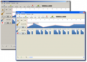
With Jokosher 0.11.1 on the verge of release I think it’s time that I made my not-so-secret project slightly more public. For the past few months I’ve been slaving away to bring Jokosher to the poor unfortunate souls who, for whatever reason, are still stuck using Windows. That task is now for the most part complete, as this pretty screenshot will attest:

Jokosher running on Windows

Testers Wanted

Jokosher’s 0.11.2 release will feature an easy to install Windows package, however I’m making a release candidate available now in the hopes that any major bugs can be discovered before the main public release. So if you have a Windows machine handy and feel like having a fiddle with Jokosher just download the installer package below. Everything you need is included in that one package, so installing it should be no different than installing any other Windows application. Then if you find any bugs please report them in the Jokosher bug tracker.


February 10, 2009

Announcing Tango Friends
Mike @ 8:44 pm

With only my EeePC available (and so no real work to distract me) on the way back from FOSDEM I decided to pass the time by hacking together a little web interface to TangoGPS’s public friends server, which allows TangoGPS users to share their location with other Tango users. So now you can stalk your OpenMoko toting friends even easier from any internet enabled computer. It uses OpenStreetMap for the maps and automatically queries the tango friends sever every 10 minutes.

It can be found at http://mikeasoft.com/~mike/tangofriends.


« Previous PageNext Page »

Powered by WordPress